← survey home · UK climbs · US climbs · Swiss climbs · Austrian climbs · French climbs
Every climb on one map
All 21,803 published climbs — the UK, the US, Switzerland, Austria and France on one map (3,487 in this country) — coloured by their steepest 25 m. Click a dot for the climb’s page; the buttons below re-frame the map on another country. Coverage follows the open LiDAR record — an empty region usually means missing data, not missing hills.
Browse all 3487 UK climbs — the full rankings →
· · frame: © OpenStreetMap contributors · topo tiles © OpenTopoMap (CC-BY-SA) · vector tiles OpenFreeMap
The interactive map could not load (the map library or the basemap tiles are unreachable). The survey’s own picture of the same climbs:
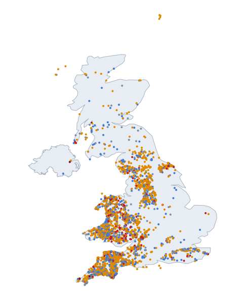
The two optional layers show the survey behind the pages: profiled roads carry a full measured gradient ladder but sit below the page cutoffs (or await review); coarse-only candidates passed only the 50 m screen — unverified, some will be terrain-model artifacts. Both are drawn as hollow rings (○ profiled, ○ coarse), never as filled dots: a filled dot is always a page, and its colour is always the 25 m gradient, on this map and the US one. Together they are the ~54,000 roads measured so far; the map is a picture, the tables are the product.
Coverage footprint — shaded ground is where the survey holds open 1 m LiDAR and has screened every public road: England and Wales as national composites, Scotland where the national programme has published so far, Northern Ireland’s river-basin surveys. Unshaded ground is where no open 1 m LiDAR was in the record when the survey ran: not “no hills”, not yet measurable. The footprint is computed from the survey’s own tile archive, never asserted.
Filled dots are climb pages. Dot colour: ● <15% ● 15–20% ● 20–25% ● 25–30% ● 30%+ — steepest 25 m window, the same figure the tables rank by. A grey-blue or blue dot is a page that earned its place another way (a long climb, a big total ascent, a listed or founding climb) — the same rule in every country.