LIVING SURVEY — measurements are reviewed continuously as new data and local evidence arrive. Seen a sign, a gate, or a better name? Submit an updateno account needed · photos welcome via GitHub
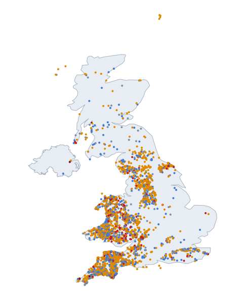
All 21,803 published climbs — the UK, the US, Switzerland, Austria and France on one map —
coloured by their steepest 25 m. Click a dot for the climb’s
page; the buttons below re-frame the map on another country. Coverage
follows the open LiDAR record — an empty region usually means
missing data, not missing hills.
The interactive map could not load (the map
library or the basemap tiles are unreachable). The survey’s own
picture of the same climbs:
Coverage footprint — Each country's map page shades the survey's own LiDAR footprint; this page frames the whole survey. Unshaded ground is
where no open 1 m LiDAR was in the record when the survey ran:
not “no hills”, not yet measurable. The footprint is
computed from the survey’s own tile archive, never asserted.
Filled dots are climb pages. Dot colour: ●
<15% ● 15–20%
● 20–25%
● 25–30%
● 30%+ — steepest
25 m window, the same figure the tables rank by. A grey-blue or
blue dot is a page that earned its place another way (a long climb, a
big total ascent, a listed or founding climb) — the same rule in
every country.