New England Hill Climbs — road gradients measured by LiDAR
The survey's first steps outside the UK: a founding set of famous New England climbs — the gap roads of the Green Mountains, the Northeast's classic hillclimb race courses, and the roads folklore calls the steepest in America — measured from the public-domain USGS 3DEP 1 m laser surveys by exactly the same published method as the UK survey. Every value states the distance it was measured over. How to read these numbers →
Coverage caveat: this is a founding set, not a survey of the region — these climbs were chosen for their fame, not found by the systematic search that produced the UK catalogue. The full discovery sweep of New England comes later; plenty of remarkable roads are not listed here yet. Where a climb's LiDAR coverage or canopy check has gaps, its page says so.
23 climbs published · 11.5 km of total ascent · Vermont, New Hampshire and Massachusetts · share
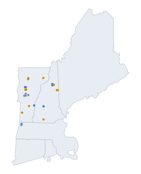 All the measured roads on one map →
The climbs, by steepest 25 m
Public roads, all surfaces — each row carries its surface.
| Climb | State | Length | Overall | Max 25 m | Surface |
|---|---|---|---|---|---|
| Hurricane Mountain Road (west side) | New Hampshire | 5.9 km | 6.2% | 23.8% | paved |
| Okemo Mountain Road Hillclimb venue | Vermont | 6.8 km | 10.3% | 21.6% | mixed surface |
| Lincoln Gap Road (east side) Steepest US mile | Vermont | 6.6 km | 6.9% | 21.3%≈ | mixed surface |
| Hurricane Mountain Road (east side) | New Hampshire | 3.7 km | 9.9% | 21.1%≈ | paved |
| Lincoln Gap Road (west side) | Vermont | 5.8 km | 7.2% | 20.3%≈ | mixed surface |
| Smugglers Notch (south side) | Vermont | 7.4 km | 4.8% | 20.0%≈ | paved |
| Jefferson Notch Road (north side) | New Hampshire | 8.5 km | 5.8% | 19.4% | gravel |
| Jefferson Notch Road (south side) | New Hampshire | 5.1 km | 5.7% | 17.4% | gravel |
| Mount Greylock (north side) BUMPS | Massachusetts | 7.8 km | 6.7% | 16.2% | paved |
| Appalachian Gap (west side) | Vermont | 12.7 km | 3.2% | 16.1% | paved |
| Middlebury Gap (east side) | Vermont | 5.5 km | 5.8% | 14.7%≈ | paved |
| Appalachian Gap (east side) BUMPS | Vermont | 5.3 km | 7.7% | 14.6%≈ | paved |
| Smugglers Notch (north side) | Vermont | 5.3 km | 6.4% | 14.1%≈ | paved |
| Bethel Mountain Road | Vermont | 6.6 km | 5.8% | 13.8% | paved |
| Brandon Gap (west side) | Vermont | 8.4 km | 5.5% | 12.9%≈ | paved |
| Mount Greylock (south side) | Massachusetts | 6.4 km | 5.2% | 12.9% | paved |
| Brandon Gap (east side) | Vermont | 5.9 km | 4.7% | 10.3% | paved |
The annex: toll roads and park roads
Fully measured like everything else, but these are private toll roads or state-park summit roads — access is controlled (fees, gates, seasons), so they sit outside the public-road list above. Each page carries an access note.
| Climb | State | Length | Overall | Max 25 m | Surface |
|---|---|---|---|---|---|
| Burke Mountain Toll Road | Vermont | 3.9 km | 13.7% | 23.5%≈ | paved |
| Pack Monadnock (Miller State Park) | New Hampshire | 2.1 km | 11.4% | 23.3%≈ | paved |
| Mount Washington Auto Road BUMPS | New Hampshire | 12.0 km | 11.8% | 21.1% | paved |
| Mount Equinox (Skyline Drive) Hillclimb venue | Vermont | 8.5 km | 11.5% | 20.0% | paved |
| Mount Ascutney Parkway BUMPS | Vermont | 6.0 km | 11.7% | 17.9% | paved |
| Mount Kearsarge (Rollins State Park) BUMPS | New Hampshire | 4.1 km | 7.4% | 16.4% | paved |
Sources & credit
Elevation: USGS 3DEP 1 m LiDAR (public domain, courtesy of the U.S. Geological Survey), with point-cloud canopy checks from the USGS 3DEP lidar point cloud and, in Vermont, cross-checks against VCGI's statewide DSM. Road geometry: © OpenStreetMap contributors (ODbL). Summit and gap positions verified against GNIS, the federal gazetteer. Surface classifications cross-checked against state road inventories (VTrans E911 in Vermont). Race-venue recognition verified against each race's own public materials. Full terms: licensing & reuse.